RIVERS
Rivers
In order to have more general information about different routes of rivers navigation, we refer to websites organizations in our members page and useful links.
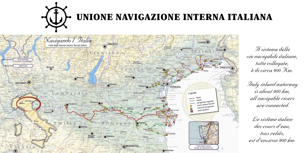
To have all information about technical data such as bridges, locks, backdrops, opening hours, you can refer to Territorial Systems for the part of the Venetian waterways and to the ‘Interregional Agency for Po about path of the River Po and the Linea Fissero Canal Bianco.
The River Sile: ROUTE Lagoon of Venice-Treviso and vice versa
The River Sile comes from various springs which are distributed between Casacorba Vedelago (TV) and Torreselle of Piombino Dese (PD). Flows with a certain sinuosity from west to east and, when it touches Treviso, the headtown of the marca trevigiana, it goes to the south-east direction towards the Venice lagoon. Once when it flowed flowed in Portegrandi/ Quarto d’Altino, but in 1683 the Republic of Venice diverted its course through the channel Taglio del Sile, which transfers the water on the old bed of the Piave river, which has been diverted to the east (and the last part is also called Piave Vecchia). Flows into the Adriatic Sea, going to divide the Lido di Jesolo from Cavallino coast (Port of Piave Vecchia). However in Portegrandi, the old course is still followed by a branch called Silone, which let access to the lagoon of Venice (boat traffic is regulated by sluices). Silone proceeds among the marshes and it is extended from the channel of Borgognoni-channel Burano. The entire course of the river is protected by Park of the River Sile.
- Length: 90.49 km
- Width: max: 60 m
- Tributaries to the right: Piovega, Dosson, Bigonzo, Servant
- Left tributaries: Corbetta, channel Eaves, Search, Botteniga, Limbraga, Storga, mMelma, Nerbon, Musestre
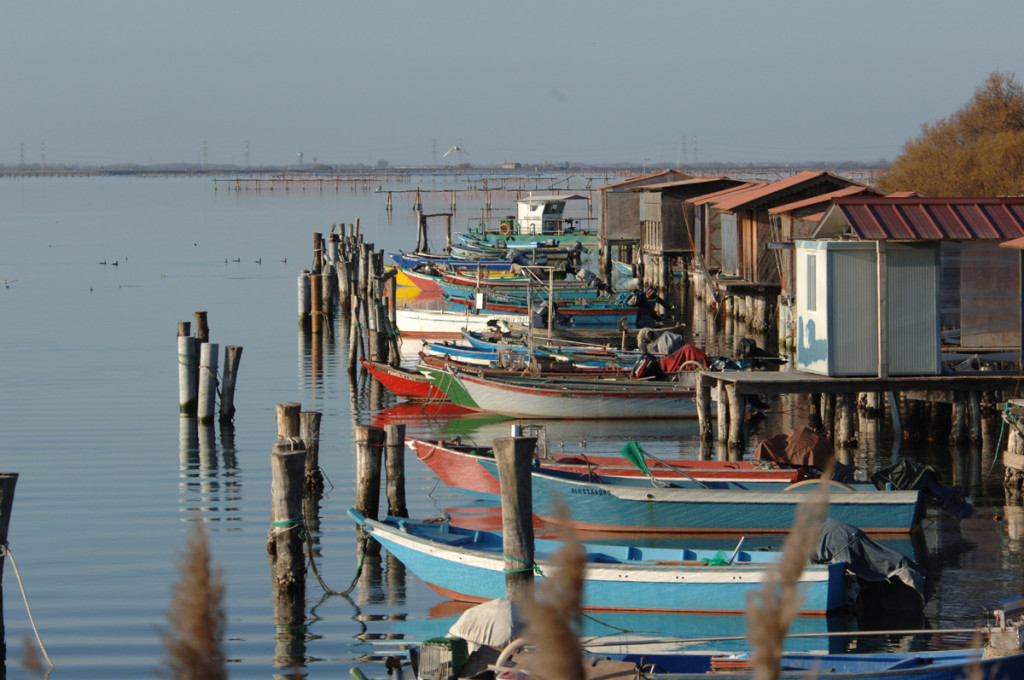
POINTS OF INTEREST The river network, Navigable in this section primarily with the canoe, it branches along the passage of Sile in an environment of rare naturalistic value where flora and fauna live in perfect union in the swamp finding their ideal habitat. An exclusive area that the population of Treviso has been able to protect , preserving the structures used by the people of the river: from “cavane” for the shelter of the boats, the “patane” with the flat bottom, the big house, the mill, the fish. Even today one of the activities practiced along the Sile resides in breeding of freshwater fish, highlighted by sturgeon called “Sturgeon Sile“: Breeding, fish and educational farm to avoid losing the values of the past, but touching them on to the younger.
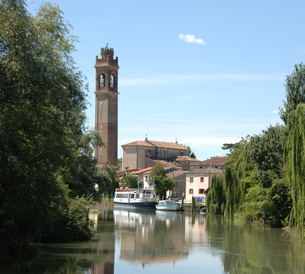
- The second stretch of the river, navigable by boat or by the ‘houseboat, part of the city of Treviso that since the thirteenth century., was Signoria, then handed it to the Serenissima, was subjugated by Napoleon and finally, in 1866, became the city of the Kingdom of Italy. Today Treviso preserves the heritage and values of this noble city of water of the Brand. Its history has always been linked to the Sile which formed an important communication and commercial, reminded Casier in “Cemetery of Burci” Impressive boats used to heavy transport until 1970. History, culture and gastronomy highlighted, because of the nature of this area full of springs and streams, from Chicory red of Treviso: An exclusive product internationally renowned. The slow flow of the Sile leads us to know more countries and localities with their values until you reach the Adriatic directly or browsing in the Venice Lagoon.
- Treviso: Docking with cement dock, near the Bridge of the hump in the center of Treviso. Casier: Docking with cement dock in downtown Casier. Casale sul Sile: Docking with cement dock, near the Church of Casale sul Sile.
- The river route starts from Treviso in search of places that characterized the life of the boatmen of the past: industrial mills, abandoned and Burci cleats with the signs of their hard work. Along the way we meet the hydroelectric plant Silea With the navigation lock that allows you to navigate downstream of Sile. If you are unable to agree on the opening of the basin, it is advisable to navigate along the route Treviso – hydroelectric plant in kayaks and only the hydroelectric plant – Casale sul Sile on boat.
The river Brenta: route Venice lagoon – Padua and vice versa
The Riviera del Brenta is an urban area located in the province of Venice, and stretches along the banks of Brenta Canal. It is the ancient bed of the natural River Brenta: branches off from the latter to the height of Stra and, running substantially from west to east, flows into Venice lagoon in Fusina. It is an area of high historical value landscape, with the presence of several Venetian villas. It includes Stra, Fiesso d’Artico, Dolo, Mira, Oriago and Malcontenta.
Ina broader sense Riviera del Brenta means all the former district of Dolo, including Campagna Lupia, Campolongo Maggiore, Camponogara, Dolo, Fiesso d’Artico, Fossò, Mira, Pianiga, Stra and Vigonovo. It is together with the Miranese, one of the two districts of the central area of the province. Four of the ten municipalities are today united in ‘Union of Municipalities – City of Riviera del Brenta.
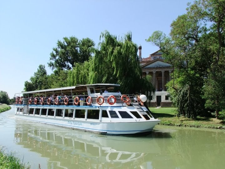
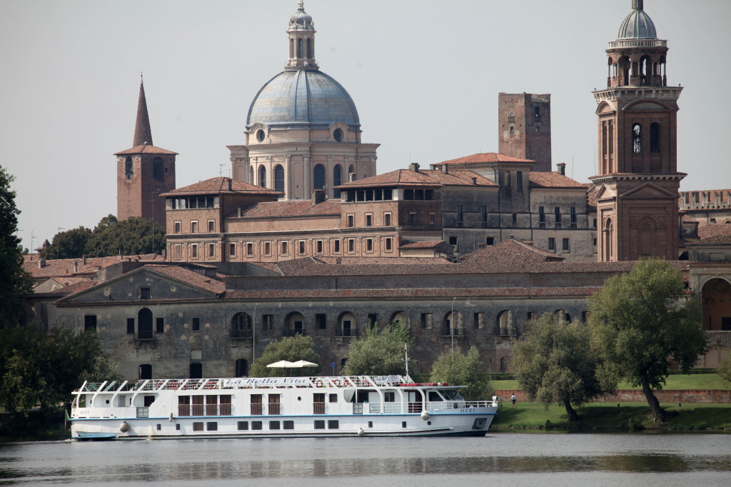
Every year, from March to October, you can make nice excursions and minicruises boat, sailing between the Venetian Villas of Riviera. The boats and motorboats panoramic, sailing along the Brenta Riviera, from Padua towards Venice and vice versa, between art and history, along the streets of the ancient Venetian “Burchielli” of ‘700.
The Burchiello was a typical Venetian boat dedicated to passengers transport, with a large wooden cabin, with three or four balconies, finely worked and decorated. The Burchiello were used by wealthy Venetians classes to reach from their villas from cities to countryside. For a long time, but even today the Burchiello and other boats, are a service line coaches, tracing the Brenta Riviera from Padua to Venice and vice versa. While the guides on board illustrate the history, culture and art of the Brenta Villas. The navigation is done with boats from 50 to 120 passengers.
The navigation programs, for both individuals and groups, include boat trips from Venice to Padua (Padova, Stra, Dolo, Mira, Oriago, Malcontenta, Fusina, Venezia) or from Venice to Padua (Venice, Fusina, Malcontenta, Oriago, Mira, Dolo , Stra, Padova) and guided tour to the magnificent Venetian villas. The hike recommended for whole day, include navigation, guidance, stop and visit inside three Venetian villas and optional lunch at a restaurant along the Riviera del Brenta, where the boat docks.
The Litoranea Veneta and its branches: route Venice – Trieste and vice versa
The river system has an importance at least equal to that of the main roads from traffic and communications: it was a way to reach easily the sea. Transport by water in some areas developed a lot and is strengthening, such as in the great rivers of northern Europe. Others saw the presence of boats, shrinking eventually losing importance.
In the Po Valley and in the Veneto-Friuli overlooking the Adriatic, a considerable importance was taken by waterway named “Venetian coastline“: a system of canals and rivers that allowed navigation and the transport of goods from the Venice lagoon to the Gulf of Trieste. It had moments of great development, especially from the Middle Ages onwards. At that time many settlements including Portus Gruarius (Portsmouth), Portus Tesana (Latisana), Portus Naonis (Pordenone) and Marano were actually very active, as well as meeting points and exchange between the people of the north and those of the coast.
Today
The Venetian coastline, which has as its natural beginning the Venice lagoon, Continues through the Port of Lido and crossing Channels Treporti, Pordelio Casson and touches the first stream that is the River Sile. Then you enter the Channel Cavetta up to where it meets the Cortellazzo River Piave. From here through Channels Revedoli, Largon, Commessera, Clock and Lightning and passing Bocca Volta it comes to Caorle lagoon where he continued in Channels Nicesolo, the Dead, Baseleghe, Cavanella, of Lovi, Lugugnana, New Cava, Cava Bevazzana up to river Tagliamento. With Channels Lovato and Pantani starts to cross the lagoon of Marano and Grado: then Channels Gio de Mur, New Cut, Peter Ori, Barban, Tiel, to finish its journey in the Channel Isonzato in which it flows into the Isonzo River. From here you can reach Trieste throught the sea.
The Venetian coastline itself runs along a route of 109 km and departs from the Conca del Cavallino to end at the Isonzo River. It is constitued of a complex system of channels that interconnects the rivers Sile, Piave, Livenza, Lemene, Tagliamento, Stella and Isonzo and the water in the lagoons of Venice, Caorle and Bibione, Marano and Grado. In fact, the coastal allows connection between the Venice Lagoon and the Marano and Grado through a journey of 134 km and between the Lagoon of Venice and the Po for another 60 km.
From the infrastructure point of view this waterway is part of the Waterway system Padano and that of the NortheastVenice-Brondolo-Po and Venice-Padua-Este-Battle-Brondolo. The system of the Resort with its main branches waterway is a resource long 514chilometri. In particular, within the territory of the Veneto-Friuli-Isonzo, the classification of inland waterways, as well as the Venetian coastline, recognizes the following routes:
- Pordenone: Rivers Noncello-Meduna and Livenza
- Udine: River Star
- Latisana: Fiume Tagliamento
- Portogruaro: River Lemene
- Treviso: River Sile
- San Dona di Piave River Piave
- Extension from Porto Buso Isonzo
- Connecting to Aquileia and Porto BusoThe Venetian coastline waterway with its branches falls within the category of lines Navigation 2nd class. The system Veneto-Friuli-isontino is calibrated for boats deadweight tons. 600, but being degraded in some places can be traveled more realistically by vessels from 250 to 400 ton, Returning to standard spread on navigable waterways of the European regional.The Resort with its many branches and lagoons is a true system of internal waters of interregional value because it is related economies of Veneto and Friuli Venezia Giulia.
The waterway system is recognized by the law of the Italian Parliament and recently also by the European Union. The legal source dates back to Luogotenziale Decree 31/05/1917, n. 1536, and subsequently by decree of 10.04.1928 is defined as: “COASTAL VENETA – Conca del Cavallino – Porto Nogaro and its extension from Porto Buso Isonzo (Sdobba) Grado and Barbana with directors at the Port of Monfalcone.” Law 380/90 established the waterway system Padano-Venetian. The waterway system called “Venetian Coastline” falls under the jurisdiction of Water Authority of Venice and partly under the jurisdiction of Regione Autonoma Friuli-Venezia Giulia.
The branches of the Venetian coastline from Caorle
- River PIAVE from Cortellazzo to S.Dona ‘
- River LIVENZA–MEDUNA–Noncello Porto Santa Margherita in Pordenone
- River LEMENE from Caorle to Concordia and Portogruaro
- River TAGLIAMENTO by Bevazzana Latisana
- The branches from Lignano
- River STELLA from Lignano Sabbiadoro to Precenicco
- River Aussa HORN from Marano or Porto Buso in Portogruaro
- River Natissa from Porto Buso-channel Amphora in Aquileia
The Po River: itineraries on the Po River
With its 652 km, The Po is the river Italy’s longest: Covers a basin 71,000 square kilometers, wetting four regions and across all Po Valley. Its course is powered by 141 tributaries and streams minor touches 13 provinces and 474 municipalities, affecting a population of 16 million people. The river rises at the foot of Monviso, the Piemonte Alps, until it flows into the Adriatic through a wide delta, in turn divided into six branches. The Po is also a major attraction for the environmental tourism, sports and culture: Its natural value is given by more than 60 parks, reserves, picnic areas and nature reserves, ideal for all scenarios bike paths, horse and river navigation. Extremely rich also offer indoor activities, thanks to more than 30 museums, villas and documentation centers dedicated to the river and to the events and characters related to it, to Don Camillo and Peppone to Giuseppe Verdi. Internationally the Po is recognized as the most important Italian river course also in the light of historical events, social and economic of which was and still is the theater.
The Po is a great resource for the economy the territory. Every year, from groundwater are picked up 5.3 billion cubic meters, which become 25.1 for surface water. Today, its waters are used for civilian purposes, agriculture and industry, and its power is derived electricity. On its banks is concentrated over a third of Italian industries and agricultural production, as well as more than half of the livestock. This is also why it is essential to ensure the safety of hydraulic territory: for that purpose by the ‘AIPo (Interregional Agency for the River Po), established in 2003, inheriting the functions of the former Magistrate Po, built in 1956. The Agency is responsible for the construction and maintenance of hydraulic defense works (such as embankments, many of which are used also to cycle paths), monitoring, prediction and management of floods, infrastructure for river navigation, police hydraulic.
Navigating the Po and its Delta, The real heart of river navigation, are long highways that follow natural environment and respect its rhythms. The selection of area navigation Po consists of 812 km waterway in the inland waterway network – which is the largest river in what add parts of navigable rivers and canals tributaries 12 ports/ Docks, 15 basins and 111 moorings (3 in Piemonte, 39 in Lombardy, 36 in Emilia-Romagna, 33 in Veneto). Aboard boats, canoes, houseboats and Bateau Mouches you can observe the nature between canals Delta Park, Passable in many points, and often in both directions, without the need for a license. The over 20 operators river propose different types of sailing experience on the river, from day trips to real minicruises For groups or schools. On many of the boats that ferry the river, capacious up to 300 passengers, you can relax, go fishing and load the bikes, choosing combined paths that will satisfy even the most cycling enthusiasts river.
The Delta the Po can be reached by boat from Cremona, Venice, And Mantova with stops in several cities as river, Parma Padua and Verona. Along the river Po are 8 parks and 50 nature reserves. Each park is special in its own way and in addition to the diversity of fauna and environment you can follow it and find out in various ways. In sailing, riding, walking or cycling. The activities that can be practiced are many: birdwatching, cycling, hiking, sailing and fishing to name a few. Altogether there are 380 sq km of delta included in the Regional Park of the Po Delta in Emilia-Romagna and in Delta Park Veneto. Other three parks are located in Piedmont (Po River Park stretch Cuneo, Po River Park section of Turin, the Po River Park tract Vercelli – Alexandrian) and five in Lombardy (Lombard Park of the Ticino Valley, South Park Adda, Po Park and Morbasco, Mincio Park, South Park Oglio).
The routes within the River Po and the Park Turin alternate natural landscapes with prominent signs of human presence, both historical and contemporary, and are divided into three major macro itineraries: Lake Po, Po and Po of the Kings of the Hills. In the vast Ticino Park, between Piemonte and Lombardia, there are about 780 km of cycle and pedestrian paths. Along the ancient via Francigena is of particular interest the stretch from Garlasco to Pavia. Further east, the high concentration of wetlands makes the Mantua territory place of habitats of particular value, as it ’s evident with the number of reserves and protected areas. This makes the province an ideal destination for eco tourists.
Trespassing in Emilia The Po Piacenza flows through a series of parks where they survive and are preserved botanical species almost completely extinct, such as oak swamp. The presence of extensive wetlands and sabbioni that attract many species of birds and migratory: terns, little terns, hawks, owls, woodpeckers, bee-eaters. In the last few kilometers of the river meanders the Park of the Po Delta, between the provinces of Rovigo Veneto and Ferrara and Ravenna Emilia-Romagna: here the presence of over 300 species of nesting, wintering or step, let making a great niche tourism, that of birdwatching. Along with some mammals, such as the “deer of the dunes” of Mesola Wood constitute a wealth of fauna of high value.
For fans of cycling and in particular of cycling fluvial the territory of the Po is full of offers, facilities and especially bike paths of all kinds along the banks, in countries and cities of the river are easier routes for beginners and challenging for athletes. Altogether there are about 2376 kilometers of bicycle paths on the mixed and 939 km tracks in its own lane. Tourists traveling with their bicycles can count on the services of a special reception of 200 accommodation Albergabici FIAB. There are even many events related to the sport of cycling, as various events organized by Fausto Coppi, who from 1987 deals with the promotion and the sport of cycling in the valleys of the province of Cuneo. In Vercelli a loop of 90 km can appreciate two very different environments: the plain rice to the left of the Po and the hills of Monferrato to the right. The city of Turin is particularly suitable for lovers of cycling, because it is mostly in the plains and because it has over 175 km of cycle paths. Outside the city, the route of the Po of the Lakes crosses with its 41 km the historic centers of Racconigi, Carmagnola, Carignano and Moncalieri.
Lombardia counts a number of cycle paths ranging from Pavia, Lodi, Mantova and Cremona: as part of the Lombardia by bicycle, the region has created a map that includes over 1,800 km of bike paths with the initiative ‘A Little Bike’. Ticino Park, in particular in the area of Pavia, can be explored through 122 km of slopes. The Province Rovigo mapped 12 Greenways go biking, calmly, without haste, and, a few miles south, Ferrara is called the ‘city of bicycles and walking on two wheels from the ramparts to the Jewish ghetto, to the long cycle track’ Right Po ‘, which reaches the sea and with its 130 km is one of the longest in the world.
A path of 445 miles horse riding from west to east, almost a river that goes parallel from Casale Monferrato to Delta. The Horse trail Po is part of the regional project of enhancement of the river and is the longest equestrian Italian trail, a hymn to slow travel, to enjoy the scenery from the saddle and the rhythms of nature. Served and equipped for over 40 facilities, including equestrian centers, horse stables, equestrian associations and accommodation with shelters for horses and accommodation for riders, crosses the main natural areas and parks included in the four regions, intersecting other local bridleways. The paths are also cycling and walking, with eateries close together and points of information on local history and the cultural and environmental surroundings. The first stretch of 41 km, goes from Racconigi to Moncalieri, Ending the Po Delta where it crosses paths loop around the various arms, also home to major farms. The route was opened in August 2010, with a trip-proof 12 days to test the way, and there are descriptions of particular points, junctions, trails not marked on maps, whether to go on private land.
The delta of river po
Named the “gentle giant”, the Po, the longest river in Italy, with its 650 km through the Po Valley to the Adriatic, where it flows to the delta, creating one of the largest wetlands in Europe and the Mediterranean. Jutting into the sea like a triangle with the axis on the central branch of the Po di Venezia, exactly on the 45th parallel which is the same in Turin and with the sides to the north along the Adige and south along the Po, the Po Delta is the portion of the territory’s youngest Italy. In fact, that characteristic protrusion of the upper part of the boot Italian has started forming a little less than 400 years ago and is constantly evolving.
The Po Delta Veneto extends for 786 square kilometers, of which over 160 are marshes and lagoons. The extension of the protected areas of the park is 120 square kilometers. 9 are the municipalities involved, all in the province of Rovigo: Adria Rosolina, Corby, Loreo, Papozze, Porto Tolle, Porto Viro Rosolina, Cuttack, with a total of over 73 thousand inhabitants of the entire area of the Delta.
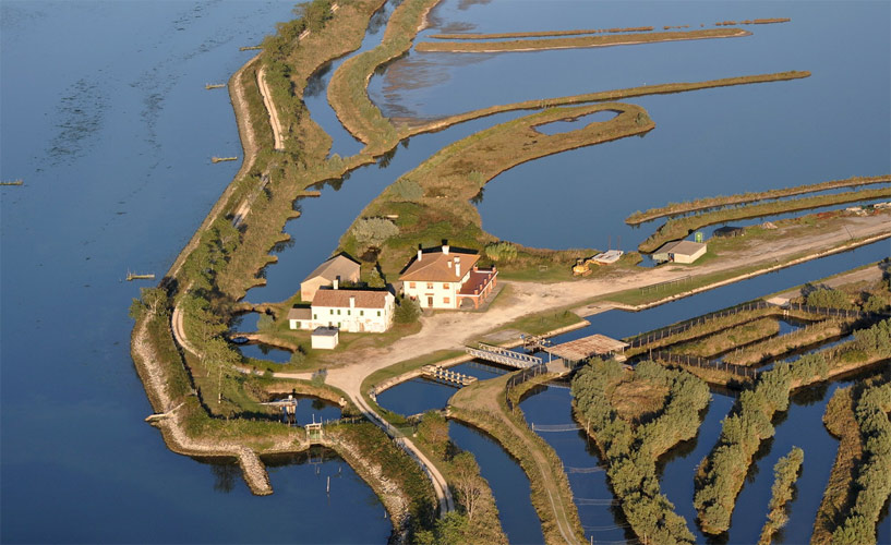
The autumn weather in the Po Delta is in some ways typical of this area. The humid environments promote a phenomenon typical of the Po Valley: the fog, which fortunately in recent years is less frequent, and allows you to appreciate the fine days typical rural landscape of the Po Delta. For those unfamiliar with the Polesine, The environment that is faced by a sense of disorientation: the spacious flat, where sometimes hardly stands a house or a small town on the horizon, seem even more dilate after harvest in late summer corn, soy or wheat. Of great interest to birdwatchers is the Veneto Regional Park of the Po Delta Poiana: Along roadsides, on poplars is easy to see kestrels and buzzards laid, while on the banks of the Po and channels herons and egrets expect to catch a few small fish. A typical plant of this period is the Salicornia veneta, it’s located on the edge of the lagoons, where the salinity of the soil exceeds 1%, between October and November assumes a deep red color. In autumn in some wetlands bag of Scardovari, All ‘Oasis of Ca ‘Mello and lagoon of Caleri, Are a natural show, definitely worth seeing.
Emilia Romagna
Most of the land (48%) is occupied by a large section of the Po Valley; the remaining area includes, in almost equal parts, a hilly and mountainous belt. The river Po, which runs through the border of Lombardia with the exception of the province of Mantova and receives along its way to the mouth a number of tributaries such as Taro, Secchia, Trebbia and Panaro, which help to increase its reach to be the maximum Pontelagoscuro, located in the province of Ferrara.
After the confluence of the Panaro the Great River begins to lick Ferrara on the border with Veneto, in the province of Rovigo, where begins Polesine, the land between the lower reaches of the rivers Po and Adige up to the Adriatic Sea. Here the river fans out and start the wide delta of the Po, which comes to cover an area of 380 km2, splitting into maain five branches – Master Po, Po della Pila, Po delle Tolle, Po Celebrities and Po di Goro – and 14 mouths. The Great River then flows in Adriatic Sea, Crossing the territories belonging to the municipalities of Rosolina, Goro, Porto Tolle and Porto Viro. The city of Ferrara is crossed by the Po but it is a secondary branch Delta. We know that the only city on the Po is Turin, but also in Emilia Romagna the river reaches the provinces of Parma,Piacenza, Reggio – Emilia and Ferrara of course.
The Po Delta includes protected natural areas established in the geographical territory of reference: Delta Regional Park dell ‘Emilia Romagna and areas in Veneto. The Po Delta, for its great value in terms of fauna and flora, was also declared a World Heritage Site by Unesco. An excursion to the Po Delta is worth, you can even have a navigation, and enjoy the whole experience that these lands offer. Hard thinking about Emilia Romagna without the river Po. Although here the longest river is the Rhine, Po is the one who gave life to the Po Valley, which sees flowing rivers and tributaries to the Valli di Comacchio and sees overlook the art and culture of the city and plains and hilly landscapes of the Apennines.
Lombardia
Lombardia is characterized by the richness of artistic heritage of its cities, witnessed centuries of history and culture, countries and art centers, that have made this region and the whole of Italy. But to the importance of this area for sure even Po gave its contribution. It comes here from Piemonte and it increases its reach thanks to the confluence of the Tanaro and Ticino, as well as of the other tributaries of the left Lambro, Adda, Oglio, Mincio and smaller rivers . To the south of Pavia, with a range of over 500m3 / s, Po begins to make a room in his bed to the boats, even large.
Po in Lombardia The portal of the region that joins the provinces bordering the Po through navigable routes, has precisely the aim of tracing a thread between the provinces of Pavia, Lodi, Cremona and Mantova, United for obvious geographical reasons and stories from their traditional cultures. Marshes, oxbow lakes, floodplains, but also forests, cultivated fields and the whole system of streams and channels are crucial for all the regional and national territory. But the Po that acts as a conductor between these provinces also serves as the border between Lombardia and Emilia Romagna for hundreds of kilometers in the southern part of the Region.
Above the area that includes the provinces Riparian can find a completely different atmosphere from that of the flat southern part; further up north more we find ourselves in a dense network of rivers and streams, and tributaries of the emissaries Lakes of Garda, Como and Iseo to quote the most, which in turn will merge their waters into the Po. The Alps that surround from the Lombardy frame the beautiful scenery of lakes and rivers immersed in the mountains. Twenty-four are the parks that the Region has decided to protect and preserve because of their beautiful flora and fauna. The Park dell ‘Adamello Nestled in the Rhaetian Alps, and the Park dell ‘Alto Garda Bresciano with features overhanging rocks in the lake, are also the subject of great European interest, since they got the European Charter for Development Sustainable in Areas Protected. Already looking on the map Lombardy shows its multi-faceted nature. Divided almost equally into three zones from top to bottom, with the lakes and the sources of the rivers in the north, everything seems to move to the south, when the waters of rivers and lakes flow into the Great River.
Veneto
With its wealth landscape and artistic and cultural heritage, has about 60 million of Tourists during the whole year. This is sure a contribution of Venice but other provinces have anyway a cultural and unique history. Among Rovigo a delightful town, is the background to the area of Polesine. This territory is located between rivers Adige and Po to the Adriatic and also includes the southern part of the Province of Verona and the City of Cavarzere in the Province of Venice.
After covering the southern border of the Veneto, Po goes to the great delta. Here it is divided into five main branches. Visiting the delta of the river you face a place where nature and civilization can deal together in peace.. . The geographical particularities of the region is in its own borders with the mountains surrounding the north, the many rivers flowing into the Adriatic Sea at the mouth of the Tagliamento and the Po delta and the sea lapping the shores. Than over the centuries have held steady waters of the river, have reclaimed the land and brought their traditions, but did not change the original appearance of these stretches. In the Delta nature, history ,tradition, culture and art intertwine, showing to the visitor a unique and stunning landscape. Here is the campaign, The valleys from peach, The lagoons or shallows, The levees populated by rich vegetation and typical paleo riverbeds, traces of riverbeds abandoned by the stream.
‘Entity Park Po Delta Veneto and other associations organize itineraries Waterways and cycling to admire the scenic beauty of this area. The Po Delta is a natural park and the area of interest of humanitarian Unesco, Is considered one of the areas of greatest interest birdlife of Italy.
Piemonte
The river Po borns in Piemonte at the foot of Monviso , the longest and most important in Italy. From here to the mouth of the Po, it drags along its waters ancient stories, traditions and breathtaking landscapes. With its 652 km length across four regions (Piedmont, Emilia-Romagna, Veneto and Lombardy) and 13 coastal provinces (Cuneo in Piedmont, Turin, Vercelli, Alessandria), wetting 183 municipalities. The Piedmont is represented mostly by mountainous and hilly areas only one third the level areas. It ‘just that arise from the Alps most of the 141 tributaries of the Po, which give growth and development of the Great River until it reaches the area of 71,000 km2, one quarter of the national territory.
The confluence of rivers into Po gives birth to oases and parks often considered natural reserves for quantity and quality of resources offered of fauna and flora. For example the case of the confluence of Sesia and Grain, Tanaro or Garzaia of Valence, The latter only colony of nesting of the Piedmont ‘heron red. To safeguard and promote the geographical area of the river, Piemonte Region in 1900 established a Safeguard system of the range of the Po River, divided in the stretch of the Po Cuneo, Turin and Vercelli / Alexandrian, to protect the river eco system.
By source Pian del Re where he was born in about 2000 meters above sea level, in the Po plain ends after just twenty kilometers in area Revello, Skirting the territory of the city of Saluzzo. In Turin the river, although he made only a short stretch of road, already has a considerable extent which is around 100 m3 / s. Turin is the only major city on the Po, which flows under six bridges crossing even the now famous Valentino Park.
After thecapital of Savoy, the Po, heads towards the foothills of Monferrato coming to flat of Vercelli. A must if you are in a visit to Piedmont paddies the Vercelli and Lomellina when the plain becomes an expanse flooded, divided into many paintings by small streets.
From the confluence of the Tanaro before and after the Ticino, Po begins to have substantial dimensions. But we are in Lombard lands, south of Pavia and here on the Po becomes navigable, to the mouth. The route which the Po accomplished through villages, rice paddies and swamps is not simply a water slide. 40% of our country’s GDP is produced in the basin of the river. Po is nature and city, tradition and future, Is an inexhaustible source of productive resources, a testimony of stories that have joined them to the river, making them linked together.
The padan Waterway (Fissero Tartaro Canal Bianco)
The waterway Fissero-Tartaro-Canalbianco, Also called Fissero Tartar-Canalbianco-Po di Levante or Mantova-Sea, is a waterway long 135 km connecting Mantova with Adriatic Sea through the eastern part of the province of Mantua, a short section of low Verona and throughout the province of Rovigo.
The first part is long 22 km and constituted by the channel Fissero, from the incile to the basin Valdaro (At the port of Mantua) to the confluence in River Tartaro, shortly before the basin Trevenzuolo (In common Ostiglia). The second portion, lenght 18 km, consists of the final stretch of the river Tartar, from confluence with Fissero until the basin Turret Veneta. The third section ,long 78 km, is constituted by the Canalbianco, A canall derived almost entirely from an ancient riverbed of Tartarus; running from the basin Turret Veneta until the basin Time Grimana. The fourth stretch, along 17 km, A canal is created from an old branch of the Po delta, called Po di Levante; running from the basin Time Grimana up to mouth in town Porto Levante the town of Port Viro. The waterway allows navigation boats of the class V European (1500-1600 tons).
From 1938 until the Second World War was then dug a diversion of Canalbianco at Adria and were built basins Governolo and Baricetta. The work began in 1961 with the installation of the section between the incile and Trevenzuolo and later in 1985 with the construction of the basins of Trevenzuolo, Torretta, of Bussari (Shared Bosaro) and Canda. By 1994 much of the tract was again arranged to allow navigation to vessels of the class V European. The last work included the arming of the mouth, completed in 2000, and the rise of some bridges, completed in 2001.
The line navigable Mantua – Venice, Constituted by waterways Fissero – Tartarus – Canalbianco – Po di Levante and Po – Brondolo made for commercial shipping is also an extraordinary highway of water available at the Port: from the heart of the Po Valley, along tens of kilometers and through pleasant countryside and urban centers, are arrives to the sea through the waterway Po – Brondolo the Venetian lagoon and then to Venice.
The Navicelli canal: route Pisa – Livorno
The waterway Navicelli is a canal created between 1563 and 1575 connecting Pisa with the port of Leghorn. It takes its name from the so called Navicelli, Features boats Tuscan modest in size, used for the transport of goods from the Pisan plain, from lake of Bientina and from the area of Empoli, Being the Arno at once navigable up to Porto di Mezzo.
In the short term is expected to reopen the connection Arno-channel, to restore the possibility of navigation for vessels (including recreational) coming from the river. It ‘been called for the reopening of the total tract “historic” Pisa, whose recovery is a hypothesis of great historical and environmental interest, thanks to the possibility of establishing a service boats tourist on the model of many European cities. Currently the channel, subject to supervision by the Office of the rivers and ditches, is managed by the public company Navicelli S.p.A.., Which deals with the cure logistics on the different settlements Industrial present and the development the channel same.
The old channel Navicelli, today classified waterway, is off 35 meters and has a draft of 3.50 meters (Mediomare), for which traffic-river vessels with tonnage up to 1,200 tons, maximum length of 90 meters, draft up to 2.60 meters and speed not exceeding 6 nodes. It has a straight course for 6 nautical miles from Pisa to the curve of the floodway ‘Arno, Which is accompanied by bending at a right angle to the sea, and then come together in the same channel between Calambrone and the port of Livorno. Access to the sea for vessels takes place just across the harbor labronico, then licking the quays of the marina and the old Tuscany tower of Marzocco. From the port, at the power plant Marzocco, the channel arrives at the Customs of water, entering the center of Livorno: this stretch is navigable only for small pleasure boats.
Between Pisa and Livorno, along the banks of the canal, there are some yards naval and large carpentry metal that, thanks to the proximity of the water, can carry large artifacts (Tank-distillers) to the port of Livorno. Inside the shipyards, along the canal, are made boats / pleasure boats in steel length> 40 m. and pleasure craft resin between 25 and 40 meters. prepared and motorized.
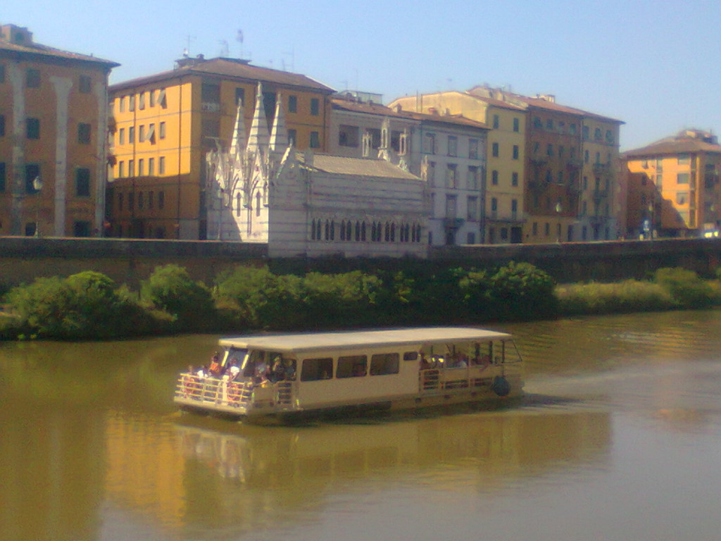
The Spa Navicelli of Pisa, in collaboration with the Cooperative Society “The Navicello” Pisa, activated from the month of November 2011 the service mini tour Boat Canal Navicelli. The waterway runs adjacent to Natural Park of San Rossore Migliarino Massaciuccoli, Characterized by landscape features and flora and fauna typical of the territory of Pisa; on the other side of the channel instead arise shipyards, internationally renowned, of which you can watch the yachts moored in the water products. In addition, adjacent to the Canal flows track bicycle which has a total length of approximately 17 km, Follows in full the waterway and is completely flat.
In the month of October 2013, In collaboration with the Cooperative Society “The Navicello” of Pisa, Pisa Train Top 5 Travel and Tours Ltd, has entered into an agreement with the Tour Operator ‘Trumpy Tours Srl “, which provided for the months of November / December 2013 and January / March 2014, every Monday, mini tours for cruise ship passengers who stop at the port of Livorno: Tourists came then in Pisana Dock through a leisurely boat trip through history and nature along the canal Navicelli.
With the upcoming opening of ‘ancient link between Channel of Navicelli and River Arno, You will complete the circuit navigable Pisa that allow you to reach the center of Pisa in boat. On Arno River, in addition to,is active already for years of service boat tours, linking the new Port of Pisa with center city.
Finally, the S.p.A. Navicelli of Pisa, in collaboration with PisaMo Spa, City of Pisa and the Municipality of Cascina, is studying a project to connect the entire area of the loop of the river Arno (From Cascina in Pisa) through an electric boat able to reach the city center of Pisa in only 20 minutes, Thus aiming at an alternative and sustainable for the citizens.
 Italiano
 English